
First visit
Blackwater Falls State Park
Blackwater Falls, Lindy Point at sunset, and Seneca Rocks with the observation trail. Base in Davis or Thomas.
Full guide to Blackwater Falls State Park →All terrain in West Virginia above 4,000 feet lies in this region, including Spruce Knob at 4,863 feet. Relict boreal communities persist here from the last glaciation: red spruce forest, sphagnum bog and heath barrens more typical of eastern Canada. The region contains all three of the state's downhill ski areas and the White Grass Nordic center, four federally designated wilderness areas, and Seneca Rocks, the only multi-pitch traditional climbing in West Virginia.
All West Virginia terrain above 4,000 feet is in this region, and conditions differ substantially from the surrounding mid-Atlantic. Temperatures run well below the valleys, weather changes quickly, and several wilderness areas are deliberately unmarked.
The region contains red spruce forest and sphagnum bog left from the last glaciation, the state's only multi-pitch traditional climbing at Seneca Rocks, and the Canaan Valley snow belt.
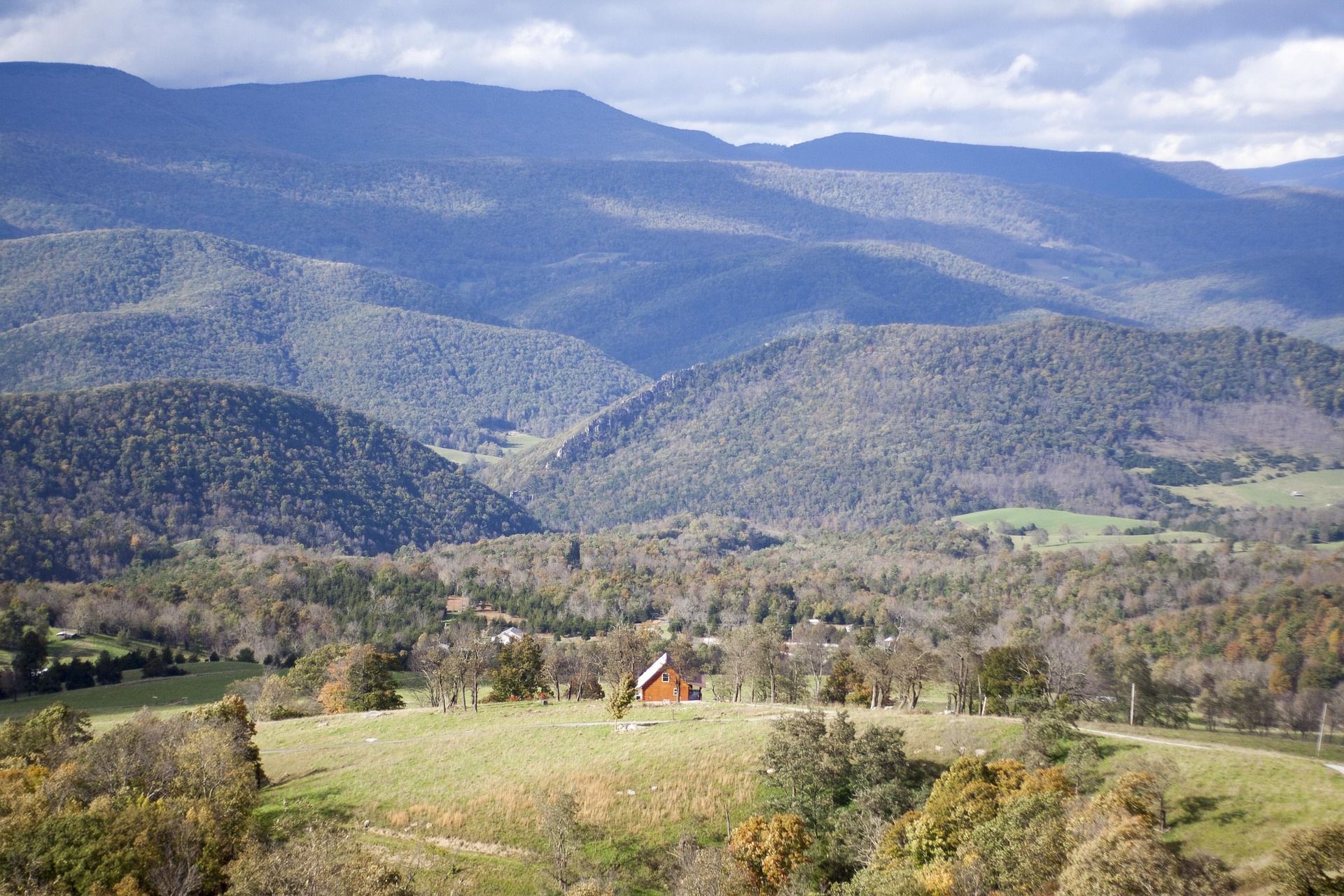
Blackwater Falls, Lindy Point at sunset, and Seneca Rocks with the observation trail. Base in Davis or Thomas.
Full guide to Blackwater Falls State Park →Get onto the Dolly Sods plateau properly — Bear Rocks at sunrise, then a night out on the heath if you can navigate.
Full guide to Dolly Sods Wilderness →North Fork Mountain for the ridge and Germany Valley, Seneca Creek for native brook trout, and White Grass in February.
Full guide to North Fork Mountain Trail →An early start for sunrise at Bear Rocks, breakfast in Davis, an afternoon on the Blackwater Canyon Trail, and Lindy Point at sunset: roughly twelve hours and the best of the region.
Forest Road 75 out to Bear Rocks is rough, slow gravel and it beats up low-clearance cars. Budget about forty-five minutes for what appears to be a fifteen-minute drive, and note that low-clearance vehicles struggle on it.
Two former coal and timber towns about two miles apart in Tucker County.
The largest town in the Potomac Highlands and the location of Monongahela National Forest headquarters, where forest maps and current road and trail information are available.
Heath barrens, sphagnum bog, wind-flagged spruce and tannin-dark creeks on a plateau above 4,000 feet.
3 days · Dec–MarThe most reliable snow belt in the mid-Atlantic, with three downhill areas and a Nordic center within twenty minutes of each other, and two small towns to come off the hill into.
3 days · Late Sep–OctColor starts on the ridges in late September and runs downhill through October.
Dolly Sods Wilderness — heath barrens, bog and open plateau above 4,000 feet.
Otter Creek and Cranberry wilderness backpacking.
Where, in this region
Local organizations
20 places in the Potomac Highlands carry hiking.
Where, in this region
Local organizations
Seneca Rocks — the East's most recognizable multi-pitch trad crag.
Where, in this region
Local organizations
Traditional Climbing across West Virginia →Seneca Rocks — the East's most recognizable multi-pitch trad crag.
Where, in this region
Local organizations
Sport Climbing across West Virginia →1 place in the Potomac Highlands carry via ferrata.
Where, in this region
White Grass, Timberline, Canaan Valley Resort and Snowshoe for winter.
Where, in this region
Local organizations
4 places in the Potomac Highlands carry snowboarding.
Where, in this region
Local organizations
6 places in the Potomac Highlands carry cross-country skiing.
Where, in this region
Local organizations
White Grass, Timberline, Canaan Valley Resort and Snowshoe for winter.
Where, in this region
Local organizations
6 places in the Potomac Highlands carry fly fishing.
Where, in this region
Local organizations
9 places in the Potomac Highlands carry mountain biking.
Where, in this region
Local organizations
The Potomac Highlands lists whitewater kayaking, without a named site of its own on this site yet.
Local organizations
12 places in the Potomac Highlands carry birding.
Where, in this region
Local organizations
Birding across West Virginia →Canaan Valley — highest large valley east of the Mississippi, a wetland complex and a national wildlife refuge.
Where, in this region
Local organizations
Wildlife Viewing across West Virginia →6 places in the Potomac Highlands carry camping.
Where, in this region
8 places in the Potomac Highlands carry primitive & dispersed camping.
Where, in this region
Local organizations
Primitive & Dispersed Camping across West Virginia →Blackwater Falls and the Blackwater Canyon.
Where, in this region
Local organizations
6 places in the Potomac Highlands carry trail running.
Where, in this region
Dolly Sods Wilderness — heath barrens, bog and open plateau above 4,000 feet.
Where, in this region
Local organizations
25 named destinations in this region.
A 17,371-acre federally designated wilderness on a plateau largely above 4,000 feet, containing wind-flagged red spruce, heath barrens, sphagnum bog and exposed rock.
The northern edge of the Dolly Sods plateau, owned by The Nature Conservancy: bare Pottsville sandstone slabs, one-sided spruce sculpted by prevailing wind, and blueberry heath dropping east into the Allegheny Front with a 3,000-foot view over the Potomac Highlands.
At 4,863 feet, the highest point in West Virginia and the high point of the entire Allegheny range.
A 900-foot fin of near-vertical Tuscarora quartzite standing above the North Fork of the South Branch — the most recognizable rock formation in the eastern United States and the only true summit in the East that can only be reached by technical climbing.
A network of trails below Spruce Knob following Seneca Creek through spruce and northern hardwood to a series of waterfalls, the largest around 20 feet.
A 57-foot falls where the Blackwater River drops into an eight-mile canyon, its water stained amber by hemlock and spruce tannins.
The highest large valley east of the Mississippi, at about 3,200 feet — a 14-mile-long bowl of wetland, bog, beaver meadow and northern hardwood that behaves climatically like central Canada.
A Canaan Valley ski area with about 1,000 feet of vertical and Salamander, a two-mile top-to-bottom run that is the longest trail in the mid-Atlantic.
The cultural heart of eastern backcountry Nordic skiing — a groomed and ungroomed network climbing the flank of Cabin Mountain from about 3,200 to over 4,000 feet, run out of a converted farmhouse with a soup-and-woodstove lodge culture that people drive four hours for.
The largest ski resort in the mid-Atlantic, built upside-down: the village sits at 4,848 feet on the summit ridge of Cheat Mountain and you ski down from it.
About 20,000 acres of dense second-growth forest in a bowl between Shavers Mountain and McGowan Mountain, drained by Otter Creek.
A 24-mile ridge trail along one of the driest mountains in the eastern United States, running through pine and oak with repeated Tuscarora quartzite outcrops looking down into Germany Valley and across at Seneca Rocks.
Twin parallel quartzite fins in Pendleton County, home to one of the original American via ferratas — a guided cable-and-rung route with a 200-foot suspension bridge strung between the two fins, roughly 150 feet above the ground.
A steep, narrow limestone canyon where the South Branch of the Potomac cuts through Cave Mountain — excellent smallmouth fishing, quiet canoe water at the right levels, dispersed camping, caves in the walls and a nineteenth-century chapel at the upper end.
A six-mile gorge on the South Branch of the Potomac between Romney and Moorefield with no road access — reachable only by boat or by the Potomac Eagle excursion train that runs alongside it.
A 3,712-acre CCC-era park in Hardy County with cabins, stables and the Cranny Crow Overlook — a rock outcrop at 3,200 feet with a view said to reach into four states.
Ten miles of former railroad grade from Thomas down the Blackwater Canyon to Hendricks, dropping through hemlock and past waterfalls with the river below.
The highest state forest in West Virginia, 9,474 acres of red spruce and northern hardwood on Rich Mountain, with rustic cabins, native brook trout in Mill Creek and almost no one there.
Two adjacent wilderness units, North and South, totaling around 12,000 acres along Laurel Fork — a beaver-worked stream valley with meadows, spruce and one of the quietest backpacking experiences in the state.
A stream cave where Gandy Creek runs underground for roughly three-quarters of a mile through a walkable passage — one of the few caves in the East traditionally crossed on foot end to end.
A CCC-built recreation area on the Shavers Fork near Elkins with a campground, picnic shelters and river access — the practical basecamp for the central Monongahela National Forest and the Otter Creek and Cheat Mountain country.
The state's only resort park with lift-served downhill skiing, plus a lodge, cabins, a golf course, snow tubing and cross-country trails, sitting on the floor of Canaan Valley beside the national wildlife refuge.
A mountain course near Snowshoe at around 4,000 feet, laid out across steep terrain with substantial elevation change between holes.
6,792 acres of high plateau immediately south of Dolly Sods, running from 3,000 feet on the southern edge to over 4,700 feet at the top of Mount Porte Crayon.
The plateau between Davis and Canaan Valley, from 3,100 to 4,145 feet, built around the eight-mile Plantation Trail with a dozen short connectors hanging off it.
Regional placement for operators based in or serving the Potomac Highlands. Capped at three per page.
List your business hereAgencies, watershed groups and access organizations tied specifically to this region.
Every organization we link to: local tourism offices, the state and federal agencies that manage the land, the nonprofits and clubs that keep access open, and the universities doing the research.
West Virginia has roughly 1.5 million acres of public land and a handful of places that carry almost all of the attention. The consequence is that a great deal of very good ground sits nearly empty, usually for one of three reasons: nobody has heard of it, the road in is gated or rough, or it is undeveloped and has nothing to advertise. Those are the places below — of them across regions.