
The classic
Blackwater Falls State Park
Blackwater Falls and Lindy Point. Amber water over a 57-foot drop, then a five-minute walk to a rock outcrop over the canyon for sunset.
Full guide to Blackwater Falls State Park →Common subjects include valley fog, the tannin-stained waterfalls of the Blackwater and Cranberry drainages, hardwood color that moves from the highest ridges to the valleys over roughly six weeks, and night sky photography inside the National Radio Quiet Zone, where restricted radio transmission coincides with very low light pollution.
The two most-photographed subjects in the state are Blackwater Falls in winter ice and sunrise at Bear Rocks. Both are accessible and both draw photographers in numbers, particularly on autumn and winter weekends.
Valley fog, tannin-stained water, roughly six weeks of autumn color moving downhill, and very low light pollution.
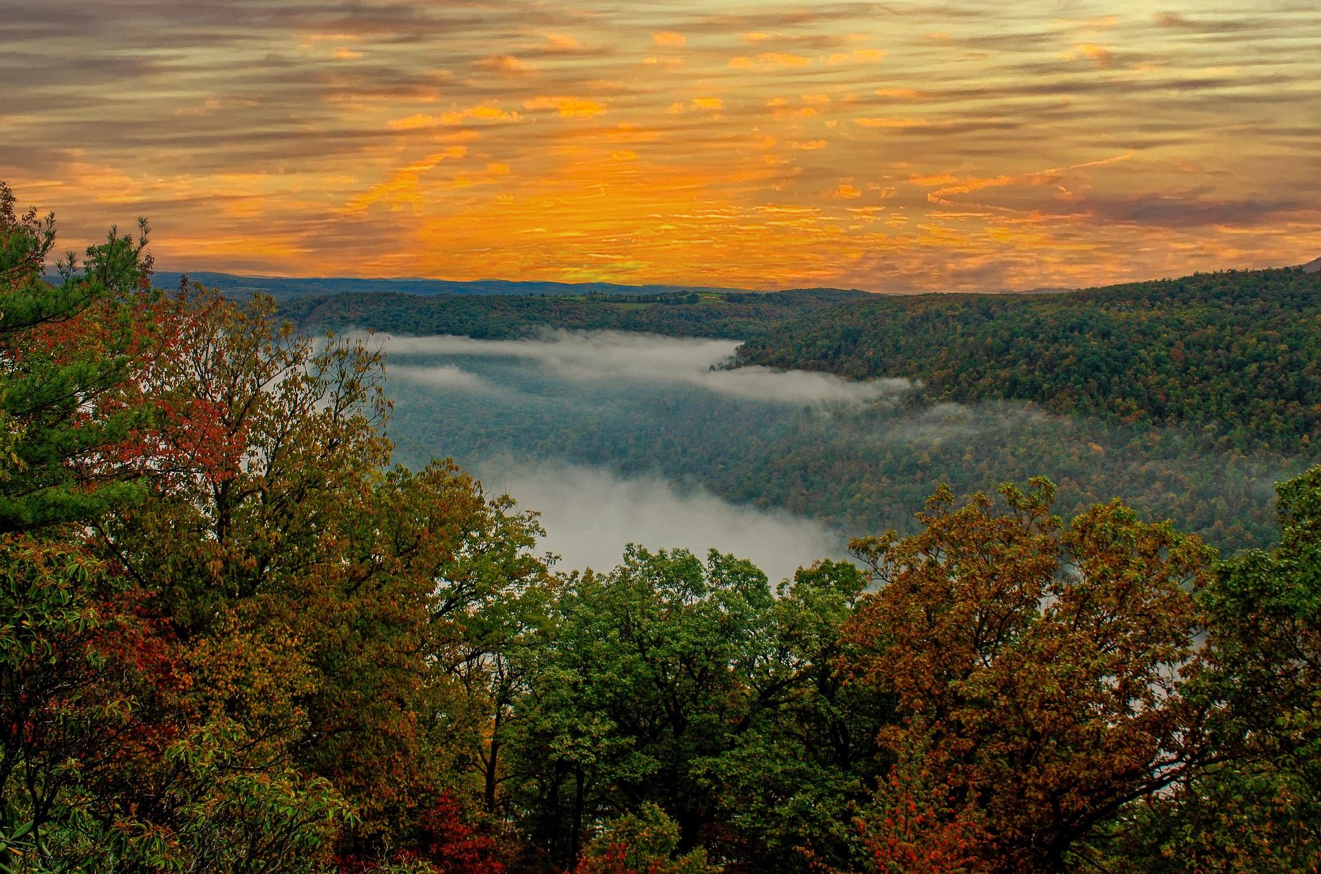
Blackwater Falls and Lindy Point. Amber water over a 57-foot drop, then a five-minute walk to a rock outcrop over the canyon for sunset.
Full guide to Blackwater Falls State Park →Bear Rocks at sunrise. Wind-sculpted spruce on bare sandstone with the Allegheny Front dropping away east. Arrive in the dark.
Full guide to Bear Rocks Preserve →The Glade Creek Grist Mill at Babcock. Best in mid-October with low sun and full color on the creek behind it.
Full guide to Babcock State Park →Fall color runs high to low over about six weeks — late September on the ridges, late October in the Ohio Valley. Peak color tracks elevation more closely than calendar date, so it is worth choosing the altitude rather than the week.
All terrain in West Virginia above 4,000 feet lies in this region, including Spruce Knob at 4,863 feet.
Sandstone climbing, big whitewater, a national parkThe New River has cut a gorge roughly 1,000 feet deep through Nuttall sandstone, protected since 2020 as New River Gorge National Park and Preserve.
Rail-trails, limestone caves, gentle river paddlingThe Greenbrier Valley sits on Greenbrier limestone, producing karst topography: sinkholes, springs, sinking streams and extensive cave systems, several with more than forty miles of surveyed passage.
A 3,030-foot steel arch carrying US 19 some 876 feet above the New River — for decades the longest single-span arch bridge in the world, and still the image most people carry of West Virginia.
A 2.4-mile point-to-point trail along the gorge rim through hemlock and rhododendron, crossing Fern Creek on a footbridge and reaching Diamond Point, an exposed rock outcrop with a view up the gorge to the bridge.
About 3.2 miles round trip on mostly level old roadbed to a rock promontory below the rim, which provides the most-photographed view of the New River Gorge Bridge.
1,400 feet above a horseshoe bend in the New, with a seven-mile view up the gorge — the widest perspective anywhere in the park.
The largest waterfall on the New River — not tall, but 1,500 feet wide, spilling across the full breadth of the river between islands at the point where the gorge begins to open.
A steep descent from the gorge rim to the ruins of the Kaymoor One coal mine and processing plant, including 821 wooden steps down the former haulage incline.
An abandoned coal town at the bottom of the gorge with the most complete surviving coal conveyor and tipple complex in the country — a 1,385-foot inclined conveyor running straight up the hillside, once operated by Henry Ford.
A long band of high-quality Nuttall sandstone on the gorge rim above Fayetteville, with a concentration of classic moderate trad and sport routes and one of the best views from any belay in the East.
Home of the Glade Creek Grist Mill, the most photographed building in West Virginia — a working reconstruction assembled from parts of three historic mills, sitting on a boulder-strewn creek.
A full resort park perched above the Bluestone Canyon, with an aerial tram descending 1,100 feet to a lodge on the river — the only state park tram in West Virginia.
A rim-top lodge above the Mill Creek arm of the New River Gorge with an aerial tram to a marina on the water.
Designated a national park and preserve in 2020, protecting roughly 53 miles of the New River where it has cut about 1,000 feet through Nuttall sandstone.
A Civil War battlefield on a bluff above the Gauley River with overlooks into the canyon and trails dropping toward the water.
A half-mile boardwalk through a formation of large Droop Sandstone blocks separated by deep crevasses, some of which hold ice into early summer.
The largest area of bogs in West Virginia — sphagnum and cranberry peat bogs holding plant communities left behind after the last glaciation, more typical of Canada than the mid-Atlantic, including carnivorous sundews and pitcher plants.
Three waterfalls in three-quarters of a mile, dropping 25, 45 and 63 feet — the last is the second-highest waterfall in West Virginia.
A 43-mile National Scenic Byway climbing over 4,500 feet across the Allegheny plateau between Richwood and US 219, with four major overlooks and access to Cranberry Glades, the Falls of Hills Creek and the Cranberry Wilderness.
A preserved company logging town and a working fleet of Shay geared steam locomotives that climb the original grades to Whittaker Station and on to Bald Knob — at 4,842 feet the second-highest point in West Virginia, reachable by train.
The world's largest fully steerable radio telescope, at the center of the National Radio Quiet Zone — a 13,000-square-mile area where radio transmissions are restricted by law.
A commercial show cave outside Lewisburg, entered by a long stairway into a single enormous chamber holding the 28-foot Snowy Chandelier stalactite.
The site of the largest Civil War battle fought in West Virginia and the state's oldest state park, with a lookout tower over the Greenbrier Valley, short trails and a museum.
A 17,371-acre federally designated wilderness on a plateau largely above 4,000 feet, containing wind-flagged red spruce, heath barrens, sphagnum bog and exposed rock.
The northern edge of the Dolly Sods plateau, owned by The Nature Conservancy: bare Pottsville sandstone slabs, one-sided spruce sculpted by prevailing wind, and blueberry heath dropping east into the Allegheny Front with a 3,000-foot view over the Potomac Highlands.
At 4,863 feet, the highest point in West Virginia and the high point of the entire Allegheny range.
A 900-foot fin of near-vertical Tuscarora quartzite standing above the North Fork of the South Branch — the most recognizable rock formation in the eastern United States and the only true summit in the East that can only be reached by technical climbing.
A 57-foot falls where the Blackwater River drops into an eight-mile canyon, its water stained amber by hemlock and spruce tannins.
A 24-mile ridge trail along one of the driest mountains in the eastern United States, running through pine and oak with repeated Tuscarora quartzite outcrops looking down into Germany Valley and across at Seneca Rocks.
Twin parallel quartzite fins in Pendleton County, home to one of the original American via ferratas — a guided cable-and-rung route with a 200-foot suspension bridge strung between the two fins, roughly 150 feet above the ground.
A 3,712-acre CCC-era park in Hardy County with cabins, stables and the Cranny Crow Overlook — a rock outcrop at 3,200 feet with a view said to reach into four states.
A 12,747-acre state forest above the Cheat River Canyon.
133 acres of virgin eastern hemlock, the last substantial stand of old-growth mixed forest remaining in West Virginia.
A series of ledge drops on the Tygart Valley River near Fairmont, popular with photographers, picnickers and — at the right levels — playboaters.
A compact park on the Middle Fork River built around a boulder-strewn swimming area and the Alum Cave boardwalk, which runs beneath an overhanging rock shelter above the river.
West Virginia's second-largest state park at 8,101 acres, in a narrow valley of hemlock and hardwood with waterfalls, cabins and a rugged trail network.
Where the Shenandoah meets the Potomac and three states meet at once, with the Appalachian Trail running straight through town and the Appalachian Trail Conservancy headquartered a block off Washington Street.
The oldest spa in the country — warm mineral springs flowing at a constant 74°F that George Washington visited as a young surveyor.
An island in the Ohio River reached by sternwheeler from Parkersburg, holding a reconstructed 1800 Palladian mansion, horse-drawn wagon tours and quiet riverbank walking.
A wide ledge falls at Glen Ferris where the Gauley and New join to form the Kanawha — a well-known bank fishing spot for hybrid striped bass, walleye and catfish, with roadside access and a historic inn across the highway.
An unusual pairing of a small developed park inside a much larger state forest in Mercer County, with two waterfalls on Camp Creek, mountain bike and equestrian trails, and camping.
A small day-use park in Mercer County built around a jagged sandstone fin standing above the highway, with a stairway to the top and a view over the southern coalfields.
A preserved nineteenth-century homestead in Harrison County with a museum, farm buildings, a swimming pool and quiet woodland trails.
The smallest park in the system, at the confluence of the Kanawha and Ohio rivers in Point Pleasant, marking the 1774 Battle of Point Pleasant.
6,792 acres of high plateau immediately south of Dolly Sods, running from 3,000 feet on the southern edge to over 4,700 feet at the top of Mount Porte Crayon.
Six weekends a year, Summersville Dam opens and the Gauley carries the most concentrated whitewater in the eastern United States.
2–3 days · Jun–OctHeath barrens, sphagnum bog, wind-flagged spruce and tannin-dark creeks on a plateau above 4,000 feet.
3 days · Dec–MarThe most reliable snow belt in the mid-Atlantic, with three downhill areas and a Nordic center within twenty minutes of each other, and two small towns to come off the hill into.
3 days · Late Sep–OctColor starts on the ridges in late September and runs downhill through October.
Reserved for a West Virginia operator serving this activity. The listings above and below it are unpaid.
List your business hereGroups that handle access, maintenance, licensing and conditions data for this activity. Starred entries publish updates worth following.
Every organization we link to: local tourism offices, the state and federal agencies that manage the land, the nonprofits and clubs that keep access open, and the universities doing the research.
West Virginia has roughly 1.5 million acres of public land and a handful of places that carry almost all of the attention. The consequence is that a great deal of very good ground sits nearly empty, usually for one of three reasons: nobody has heard of it, the road in is gated or rough, or it is undeveloped and has nothing to advertise. Those are the places below — of them across regions.