
Every organization we link to: local tourism offices, the state and federal agencies that manage the land, the nonprofits and clubs that keep access open, and the universities doing the research.
Blackwater Falls State Park
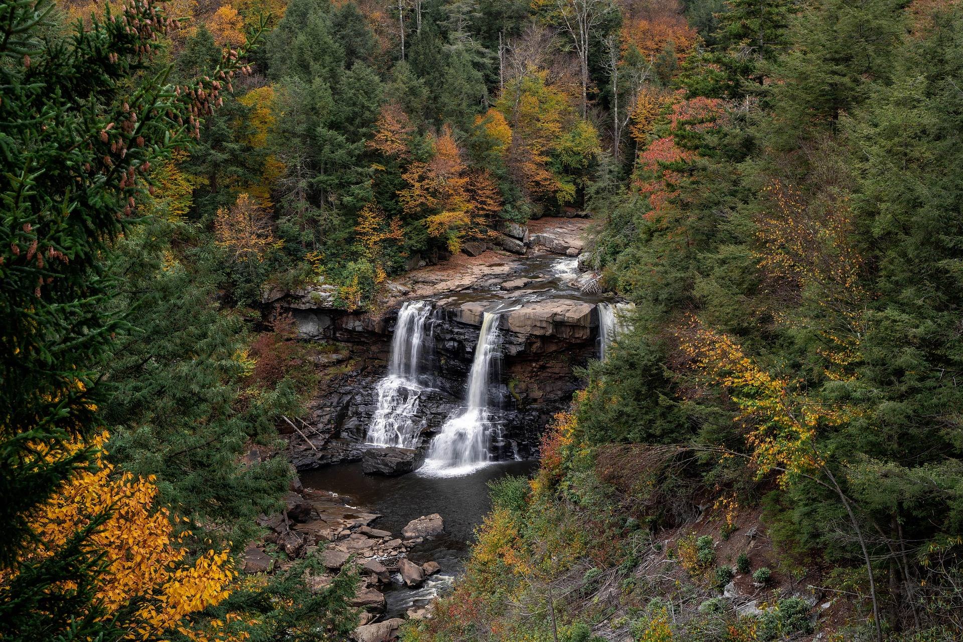
A 57-foot falls where the Blackwater River drops into an eight-mile canyon, its water stained amber by hemlock and spruce tannins. Boardwalk and stairs reach several viewing platforms. The park also holds Lindy Point — a rock outcrop over the canyon that produces the state's best-known sunset photograph — plus Elakala Falls, a lodge, cabins and the longest lift-served sledding run in the region.
Know before you go
- Lindy Point is 0.3 miles, rated moderate to difficult, and best at sunset
- Elakala Falls is a five-minute walk from the lodge and often overlooked
- The sled run uses a magic carpet lift and sells out on holiday weekends
- Pendleton Point Overlook gives the deepest canyon view
- 21 trails in all. The boardwalk to the falls is a quarter mile and more than 200 steps down
- The Gentle Trail is the paved quarter-mile alternative for anyone who cannot manage stairs
- Lindy Point is 0.3 miles, rated moderate to difficult, to an overlook the park puts at 3,000 feet
- River Road Trail is 1.56 miles on an old railroad grade and links the park to Davis
What you can do here
Lindy Point is the sunset frame — 0.3 miles, rated moderate to difficult, out to an outcrop the park puts at 3,000 feet above the canyon. Pendleton Point Overlook gives the deepest view down the eight-mile gorge, and Elakala Falls, five minutes from the lodge, gets passed over by most visitors. The 57-foot main falls run amber from hemlock and spruce tannins.
Dark sky status
Local organizations
Twenty-one trails run here. The boardwalk to the 57-foot falls is a quarter mile and more than 200 steps down; the paved Gentle Trail covers a quarter mile without them. River Road Trail is 1.56 miles on an old railroad grade linking the park to Davis, and Lindy Point is 0.3 miles rated moderate to difficult.
Trails here
Local organizations
A magic carpet lift carries you back up, which is what makes this the longest lift-served run in the region and what makes it workable with small children. Holiday weekends sell out, so come midweek or book well ahead. Operating days depend on snow — confirm with the park before you drive up.
Local organizations
Several of the park's 21 trails follow old grades, and River Road Trail's 1.56 miles of railroad bench toward Davis is the gentlest gradient on the property. Nothing published here covers grooming, track-setting or rentals. Call the park office for winter trail status and find out what is actually open before you load skis.
Trails here
Local organizations
Winter makes the boardwalk's 200-plus steps the hard way down to the falls, while the paved quarter-mile Gentle Trail stays flat. Beyond those two, 21 trails and the 1.56-mile River Road grade give straightforward walking on snow. Lindy Point's 0.3 miles to the canyon rim is rated moderate to difficult and slower underfoot in winter.
Trails here
Local organizations
River Road Trail is the obvious ride — 1.56 miles of old railroad grade running out of the park toward Davis at the gradient a railroad needed. Which of the other 20 trails are open to bikes is not published, and the falls boardwalk with its 200-plus steps plainly is not one of them. Confirm bike-legal routes at the park office.
Trails here
Local organizations
Camping appears on the park's activity list, but the record here describes a lodge and cabins rather than campsites, and gives no site count or season. What a night on the property buys is position: the quarter-mile boardwalk to the falls, Elakala five minutes from the lodge, Lindy Point at sunset. Ask the park about campground layout and reservations.
Twenty-one trails give a runner real options. River Road Trail runs 1.56 miles of railroad grade toward Davis, steady enough to hold a pace, and Lindy Point is 0.3 miles out to the rim at moderate to difficult. The boardwalk down to the falls is a quarter mile with more than 200 steps, which is stair work rather than running.
Trails here
Guides, gear and lodging near Blackwater Falls State Park
Place-level placement for operators within range of this trailhead, put-in or crag.
List your business hereNearby in the Potomac Highlands
Dolly Sods Wilderness
A 17,371-acre federally designated wilderness on a plateau largely above 4,000 feet, containing wind-flagged red spruce, heath barrens, sphagnum bog and exposed rock.
Bear Rocks Preserve
The northern edge of the Dolly Sods plateau, owned by The Nature Conservancy: bare Pottsville sandstone slabs, one-sided spruce sculpted by prevailing wind, and blueberry heath dropping east into the Allegheny Front with a 3,000-foot view over the Potomac Highlands.
Spruce Knob
At 4,863 feet, the highest point in West Virginia and the high point of the entire Allegheny range.
Seneca Rocks
A 900-foot fin of near-vertical Tuscarora quartzite standing above the North Fork of the South Branch — the most recognizable rock formation in the eastern United States and the only true summit in the East that can only be reached by technical climbing.
Seneca Creek Backcountry
A network of trails below Spruce Knob following Seneca Creek through spruce and northern hardwood to a series of waterfalls, the largest around 20 feet.
Canaan Valley
The highest large valley east of the Mississippi, at about 3,200 feet — a 14-mile-long bowl of wetland, bog, beaver meadow and northern hardwood that behaves climatically like central Canada.
West Virginia has roughly 1.5 million acres of public land and a handful of places that carry almost all of the attention. The consequence is that a great deal of very good ground sits nearly empty, usually for one of three reasons: nobody has heard of it, the road in is gated or rough, or it is undeveloped and has nothing to advertise. Those are the places below — of them across regions.